The complex will be sited on the cleared tear-drop shaped site pictured here. That is I-495 running across the top, with South Hunt Road running parallel to it.

The City Council received a presentation in December from Community and Economic Development Director Bill Scott about the project. You can read the presentation HERE. There are clear benefits for Amesbury from this project: significant tax revenue, daily traffic of users coming to Amesbury from around the region, spill over economic activity.
As I understand it, the ice rink development is consistent with the underlying zoning for the 48 South Hunt property. This means that the project is 'by-right' and should not require any special permitting. The Boston Globe reports that permitting is proceeding and that the developer hopes to break ground this summer.
I think that the site and its context on South Hunt Road is generally well-suited for this type of development and that the project will bring a variety of straight-foward benefits to Amesbury.
I do have one area of concern, however, and that is the impact of traffic related to the development on adjacent and connecting roadways, neighborhoods, and intersections.
South Hunt Road is a narrow road, with no shoulder and with modest amounts of traffic (even with the DPW facility). It goes past and through residential areas (including S. Martin Road) and terminates at a tricky intersection with Rt. 150, where off- and on-ramps are situated just across the street.
At the same time, the proposed ice rink complex will be 250,000 - 300,000 square feet in size on a 49 acre lot, with anticipated year-round operation 7 days a week, early morning through the evening.
For comparison, the new Super Wal-Mart at the intersection of Rt. 107 and Rt. 1 in Seabrook is 189,564 square feet in size (total new development at that plaza is 380,000 square feet) on a 51 acre lot. If you've been there, you have a sense of the scale, the size of the parking lot, and the substantial upgrades to the adjoining roads and intersections that were integrated with that project.
These two pictures below show the before and after of both the site and the nearby roads and intersection.
The 2005 Google Earth image shows the undeveloped site on the upper left. The 2015 Google Earth image below it shows the completed project. The new ice rink complex will be about 80,000 sq/ft less than the total of the buildings built in the new Super Wal-Mart plaze (upper left/2015); the lot size will be roughly the same.

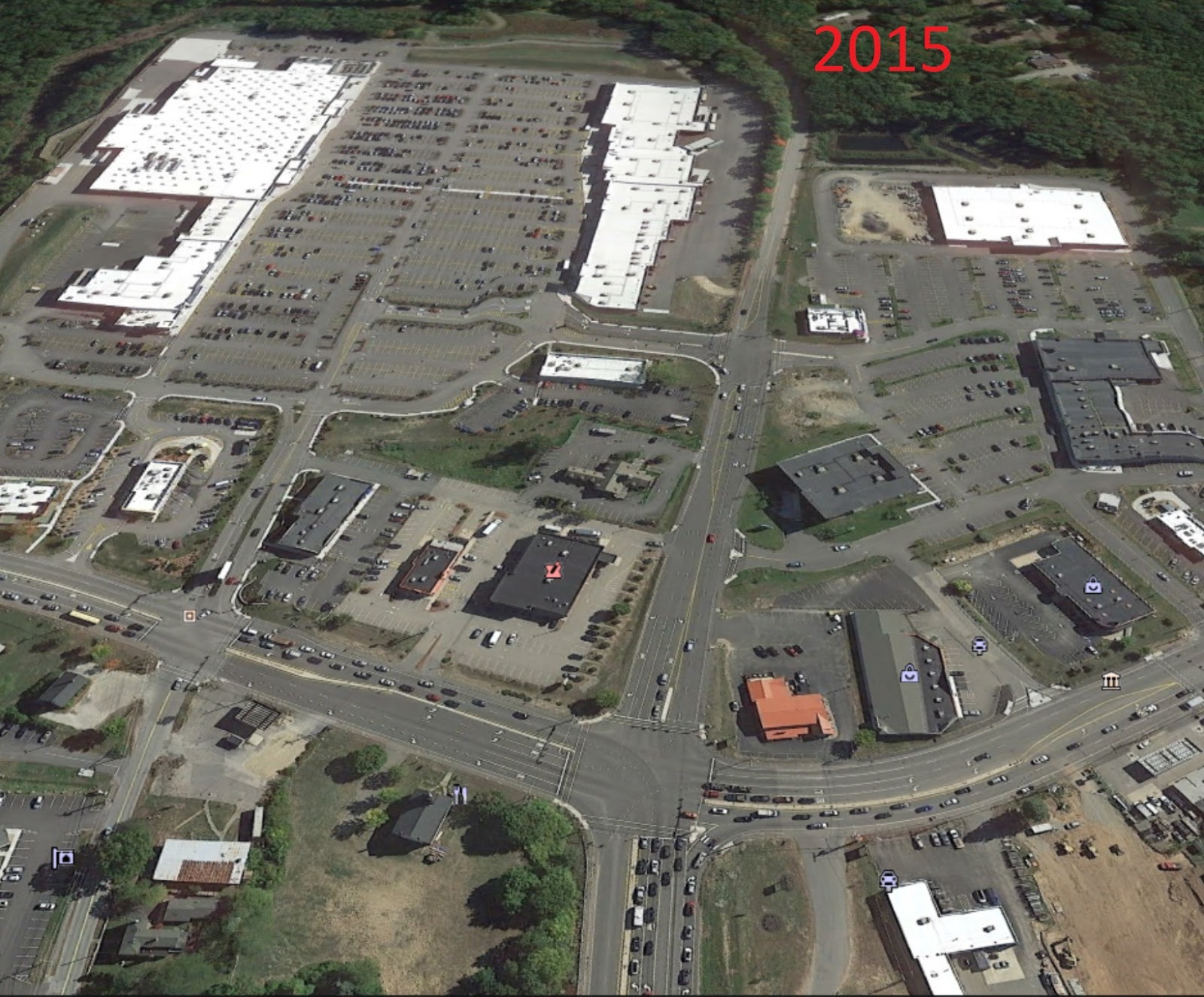
It's hard to see the detail but with the new plaza, roads and the Rt. 107/Rt.1 intersection were all widened. Lanes coming (east) on Rt. 107 went from 3 to 5. Lanes on Rt. 1 south went from 4 to 5 (at the intersection). The access road coming in down the middle went from 2 to 4 lanes at the intersection with Rt. 1. Rt. 1 north from the intersection increased to 3 lanes.
For the new ice rink complex, access has been a crucial issue. The property at 48 South Hunt Road is a bit land-locked. The December proposal included access from South Hunt Road, on property that has been owned by Waste Management. Presuming that access from South Hunt to the lot itself has been worked out and that all approvals for the project will at least require accommodations for a high volume of traffic coming and going from S. Hunt to the rink, my concerns are with the connection from 48 S. Hunt Road to Rt. 150.
The stretch of S. Hunt running from #48 to Rt. 150 is narrow and the outlet onto Rt. 150 does not strike me as remotely designed for volume.
You can see the relationship of the property to Rt. 150 in the photo below.

The ice rink lot is circled in RED. For reference, the Sports Park is circled in YELLOW. And the outlet of S. Hunt Road onto Rt. 150 (including the on-/off- ramps opposite) is circled in BLUE. I-495 runs along the right; the route into downtown Amesbury is off the map to the right. on Rt. 150 north. The residential neighborhood on S. Martin Road lies just below the Sports Park, in the wooded area with the street running across the image. (NOTE: the other big open space, right by Rt. 150, is the City-owned Titcomb Landfill. Installation of the planned solar field there has stalled.)
Drop a Super Wal-Mart + adjacent shopping plaza + parking in the RED area. Then compare the narrow road that is South Hunt (running parallel to I-495) with the kind of roadways and intersections built up for the Super Wal-Mart development in Seabrook; the difference is dramatic.
Let me note that OF COURSE the roadways around the Super Wal-Mart were already wide and built up to accommodate the other commercial development along Rt. 1 (Staples, Lowes, Market Basket, etc) as well as Rt. 1 local highway traffic in general, so the direct comparison is rough and imprecise. That said, there's no question that the new development will put road traffic pressure on South Hunt and Rt. 150.
So, I have strong concerns that while the site approvals for the rink complex have developed apace (and seem to be imminent) and the developer has plans to break ground soon, there has not been sufficient planning by the City to assess anticipated traffic volume and pattern changes and plan/design/fund solutions.
As it stands, having a Super Wal-Mart sized property (with near constant flow of users coming and going) served by the current roadways would be a bit like trying to vacuum a watermelon up with a DustBuster.
What I hope is that as this plan wends its way through the Planning Board approval process, attention is paid to larger impacts on roadway infrastructure. I've shared my concerns with the City's Planner and hope that this all proceeds in an integrated and well-planned way. To my knowledge (which may well be incomplete), impact assessment and mitigation planning/design has not been done yet, even with the potential breaking ground of rink construction this summer. I look forward to learning more.


